
Kaua‘i field project - August 2026
August 25, 2026
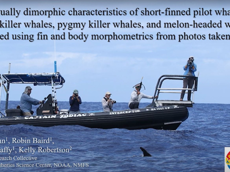
Researchers from Cascadia Research Collective are conducting a 9-day field session off Kaua'i to deploy LIMPET satellite tags on odontocete cetaceans prior to a Submarine Command Course (SCC) to be able to examine their behavior before, during, and after the training event. Click on the image below to see daily updates from the field.
Killer Whale Ecotype Study (KWEST) kicks off
July 27, 2026
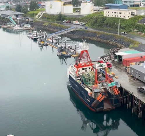
Research scientists from the University of Washington and NOAA recently departed from Kodiak, AK aboard the R/V Aquila for a 2-month research cruise focused on distinct groups of killer whales, or ecotypes, that hunt different prey and travel in different parts of the Gulf of Alaska.
Happy Whale Humpback Happenings
June 22, 2026
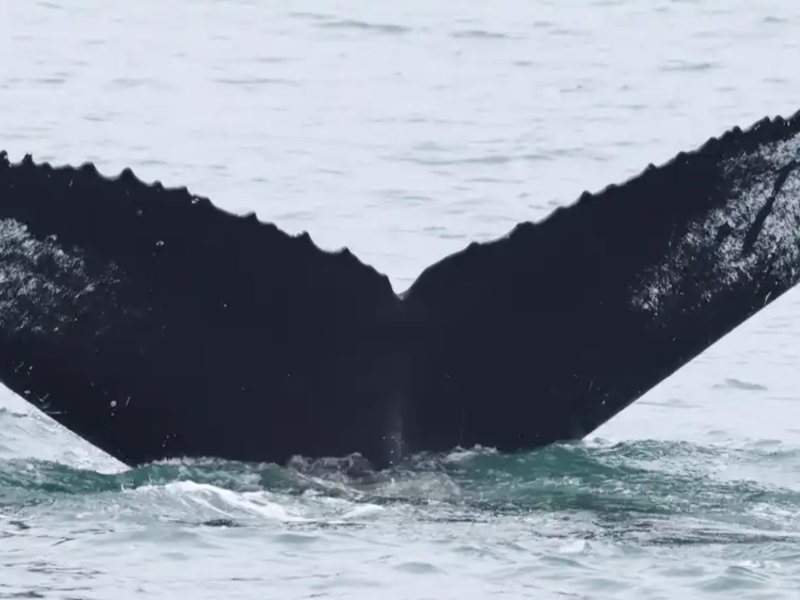
A few interesting matches have come out of our Mid-Atlantic Humpback Whale Catalog efforts and partnership with Happy Whale!
2024-2025 Large Whale Season Summary
March 24, 2025
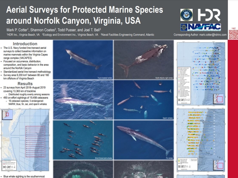
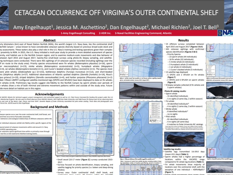
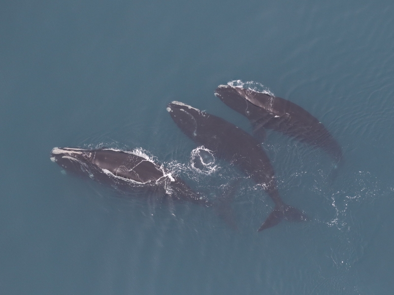
We have two separate efforts focusing on cetaceans off the coast of Virginia. The first is our Offshore (Outer Continental Shelf) Cetacean Study, which focuses primarily on deep diving odontocetes like sperm whales. The second effort is our Nearshore and Mid-Shelf Baleen Whale Monitoring Project.
Kaua'i Field Work Updates
February 20, 2025
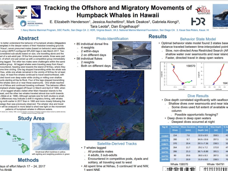
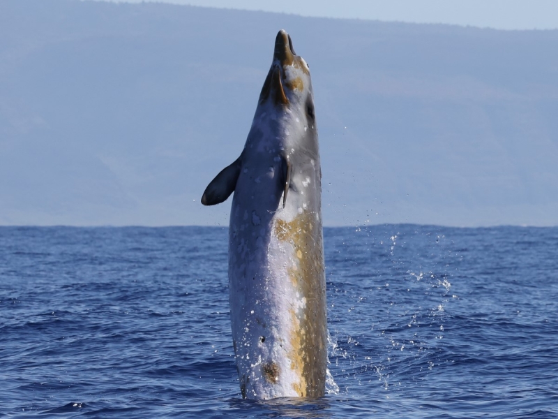
Scientists from Cascadia Research Collective recently completed a ~9-day field project off Kaua’i that started on February 9th. This project is timed to occur prior to a Submarine Command Course (SCC) training event. The primary goal is to deploy satellite telemetry tags on multiple species of odontocete cetaceans prior to the SCC, to be able to examine their behavior before, during, and after the event. This approach has been very successful in the past as a way of examining how different species respond to Navy training activities including mid-frequency active sonar (MFAS). Click through the picture below to see daily updates.
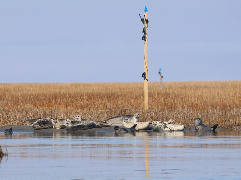
Winter is here in Virginia, and so are the seals!
January 21, 2025
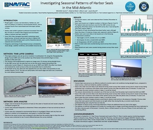
NAVFAC LANT researchers are back at it for the 11th field season of monitoring gray and harbor seals at two major haul-out locations in southeastern Virginia.
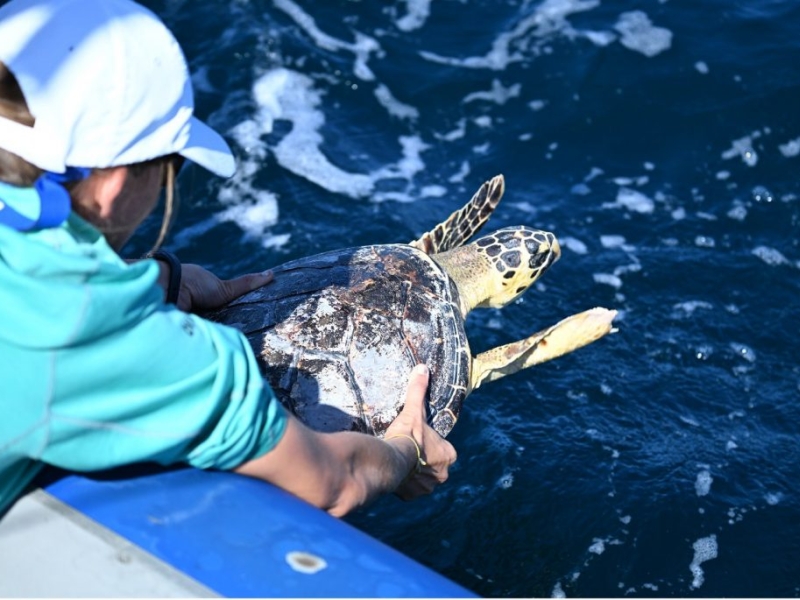
First Satellite Tag Deployments for Atlantic BRS 2024
July 8, 2024
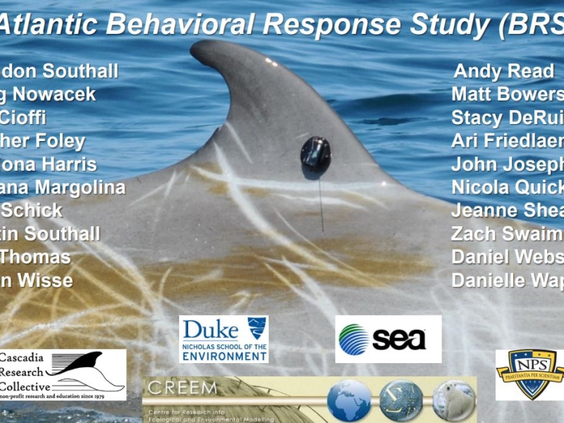
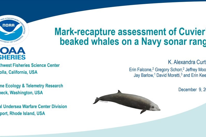
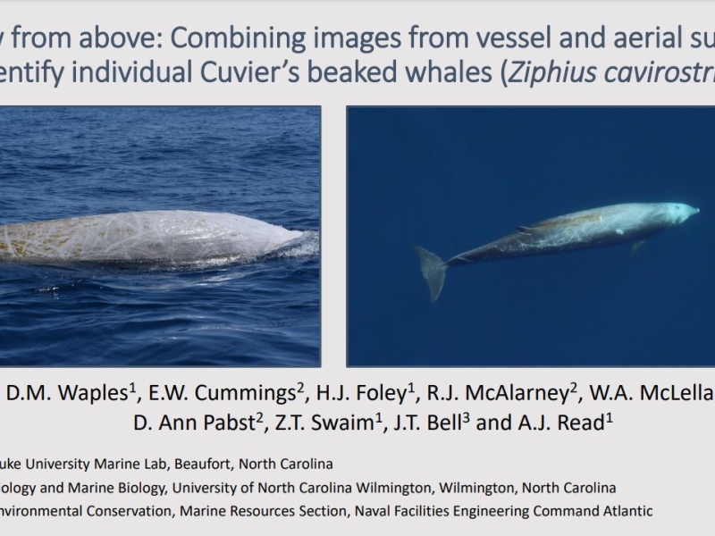
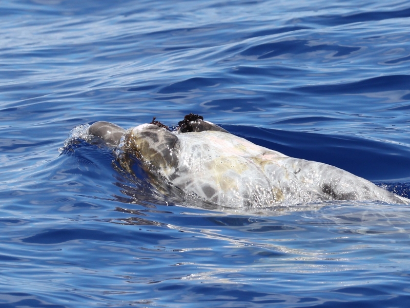
In June 2024, a Duke University team initiated the Atlantic Behavioral Response Study (BRS) by deploying satellite-linked dive recorders on goose-beaked whales (Cuvier's beaked whales) off the coast of North Carolina. These tags collect data on the whales' diving behavior and locations, enhancing understanding of their baseline activities. Additionally, the team released a rehabilitated hawksbill sea turtle named Bagheera back into the Atlantic Ocean.
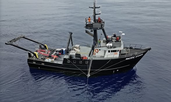
Mesoplodon mysterioso
June 13, 2024
We are thrilled to be part of the "Mystery Mesoplodon Expedition" off the west coast of Baja California searching for an elusive new species of beaked whale. Read about the initial discovery and stay tuned for updates on this exciting expedition!
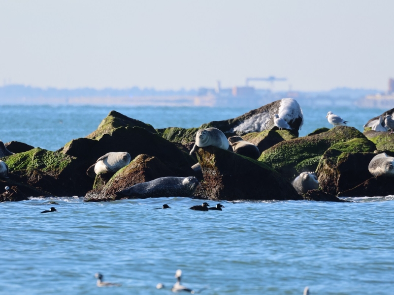
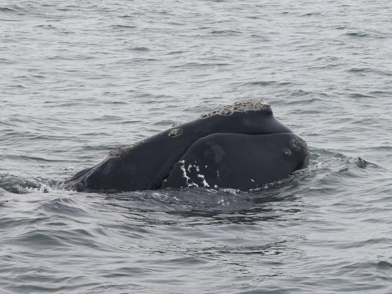
It’s Whale Season in the Mid-Atlantic!
November 20, 2023
Baleen whale season has started in the mid-Atlantic and we have several projects in the region studying their occurrence and behavior.
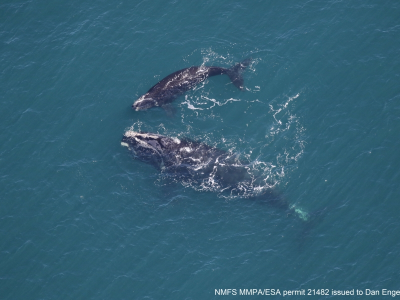
Coming full circle – right whale mom returns with calf
March 15, 2023
Previously CATS tagged Right whale "Smoke" is sighted again in VA with a calf.
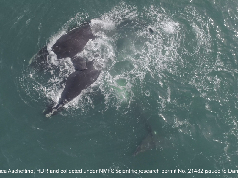
Right Whale Party in the Mid-Atlantic
February 4, 2023
A Surface Active Group of North Atlantic right whales off the coast of Virginia.
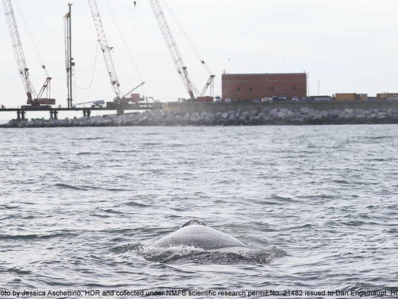
An Urban Whale
February 3, 2023
A juvenile North Atlantic right whale finds itself in a busy area.
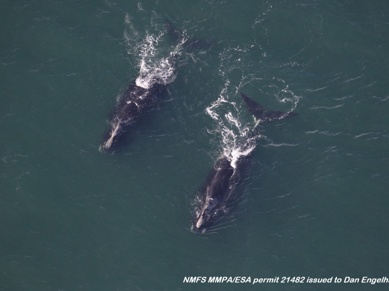
Right whales are on the move!
November 23, 2022
Two female right whales were sighted off Virginia during their southbound migration.
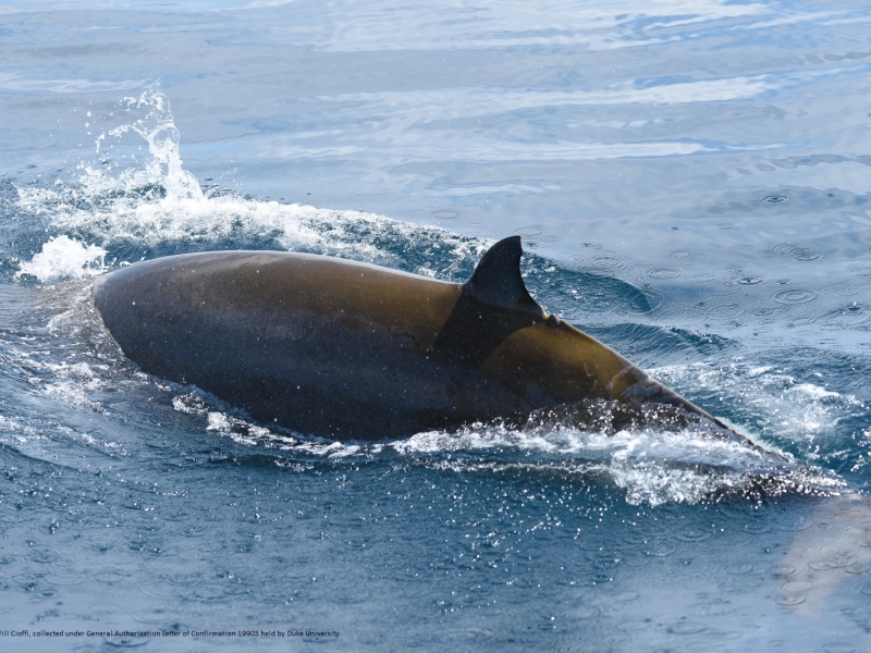
Cuvier's from Cape to Canyon
September 16, 2022
Photo ID match of a Goose-beaked whale between Cape Hatteras and Virginia Beach after two years.
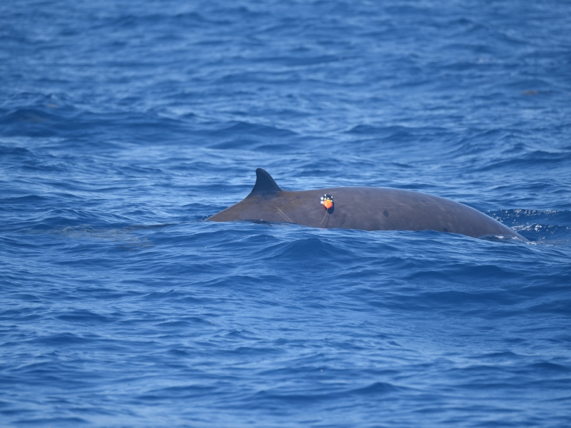
Atlantic BRS – 2022 CEE with the USS Farragut
August 26, 2022
A controlled exposure success story using a Navy ship.
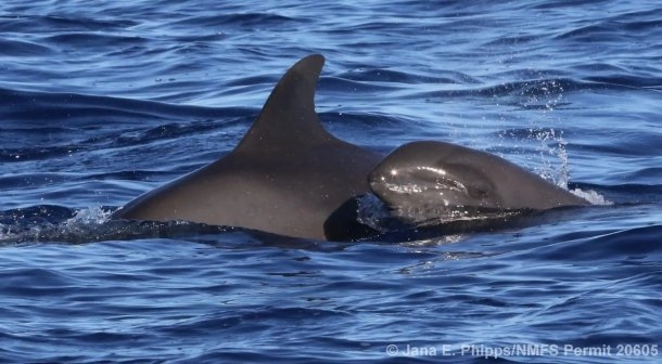
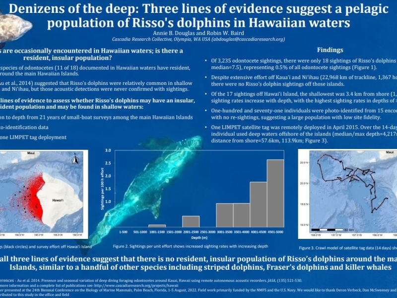
August 2022 Kaua‘i Field Project
August 18, 2022
Cascadia Research Collective began an 8-10 day field project off Kaua’i starting on August 16th. This project is timed to occur prior to a Submarine Command Course (SCC). Their primary goal is to deploy LIMPET satellite tags on one or more species of odontocete cetaceans prior to the SCC, to be able to examine their behavior before, during, and after the SCC. This approach has been very successful in the past as a way of examining how different species respond to Navy training activities including mid-frequency active sonar.
Pinniped season has begun in SE Virginia
October 27, 2021
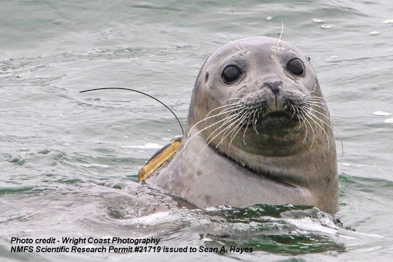
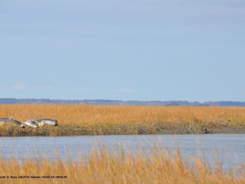
Camera traps have been installed to track seals in Virginia.
Tracking an endangered North Atlantic right whale
March 15, 2021
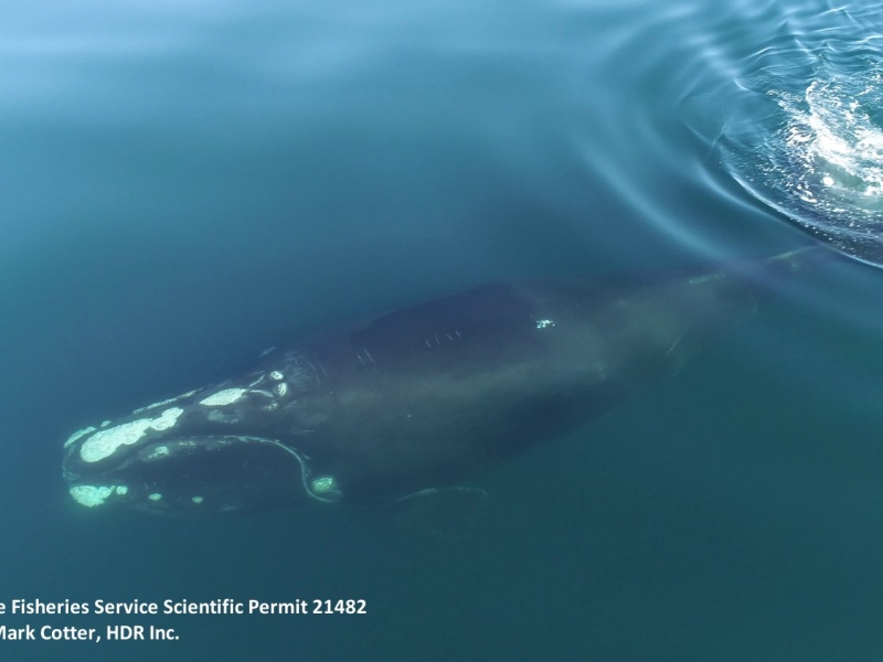
A yearling right whale was tagged off the coast of VA and tracked for 12 days.
Fantastic video of an encounter with North Atlantic right whales off the coast of Virginia Beach
January 27, 2021
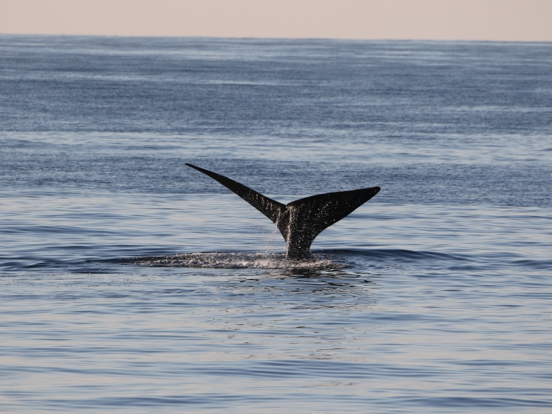
Footage of three right whales off Virginia.
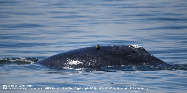
One whale tagged twice.
March 8, 2019
D-tag and limpet tag on a humpback whale.
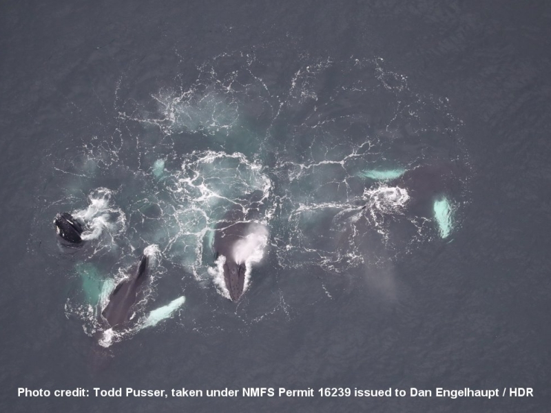
Blue whales and sei whales and right whales - OH MY!!!
April 18, 2018
A spring aggregation of endangered whales offshore.
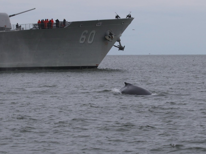
Repeat tagging customers to humpback monitoring project
January 30, 2018
Some interesting notes on site fidelity in Humpack whales.
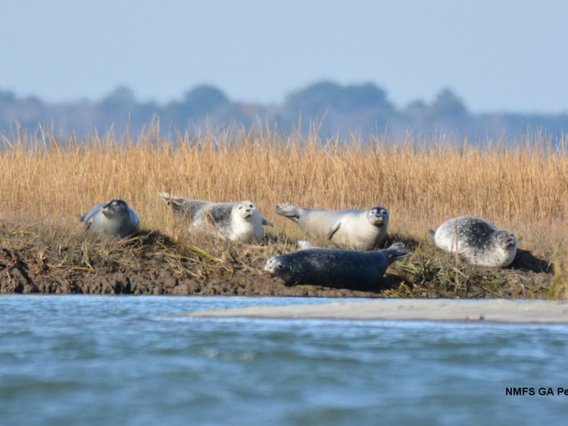
First Harbor Seal Haul-Out Survey of the Season in Virginia
December 19, 2017
Seals have arrived in Virginia
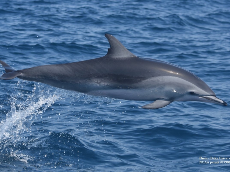
Banner day tagging odontocetes at Hatteras!
June 1, 2016
A busy field day in NC.
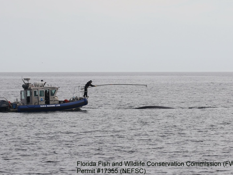
Tagging North Atlantic Right Whales
May 9, 2016
Southeast US tagging project has successful season.
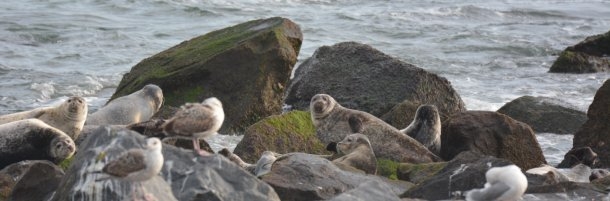
Seals of Rhode Island and Virginia
February 17, 2016
Two projects studying harbor seals on the east coast.
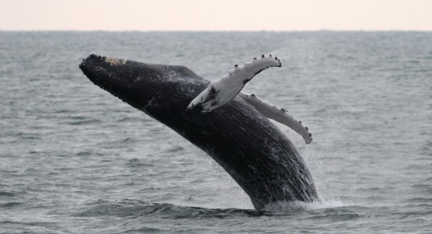
Tagging Atlantic Humpbacks
January 8, 2016
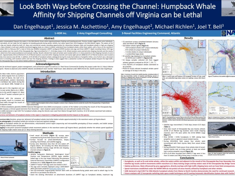
Year two of our Chesapeake Bay humpback whale project has begun!
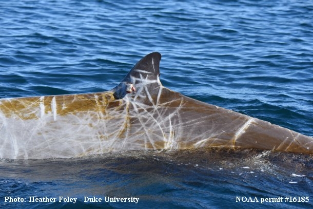
Hatteras tagging wraps up for 2015
November 10, 2015
The finale of a successful field season.
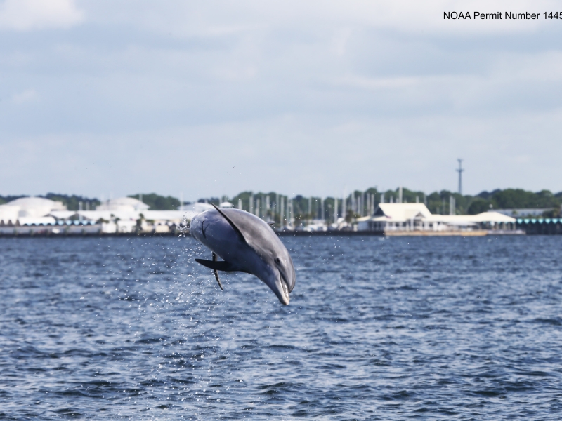
Panama City Dolphin Survey Complete!
August 12, 2015
Bottlenose dolphin photo ID efforts in Florida
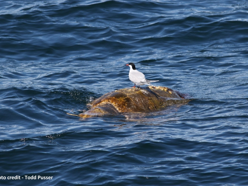
Great Day for a Mid-Atlantic Offshore Survey
April 20, 2015
Pelagic cetaceans and sea turtle sightings.
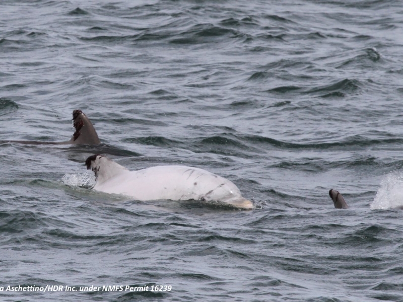
White “Leucistic” Bottlenose Dolphin Seen on Marine Mammal Survey
October 30, 2014
Leucism, like albinism, is a genetic condition that results in a lack of pigmentation in the skin.
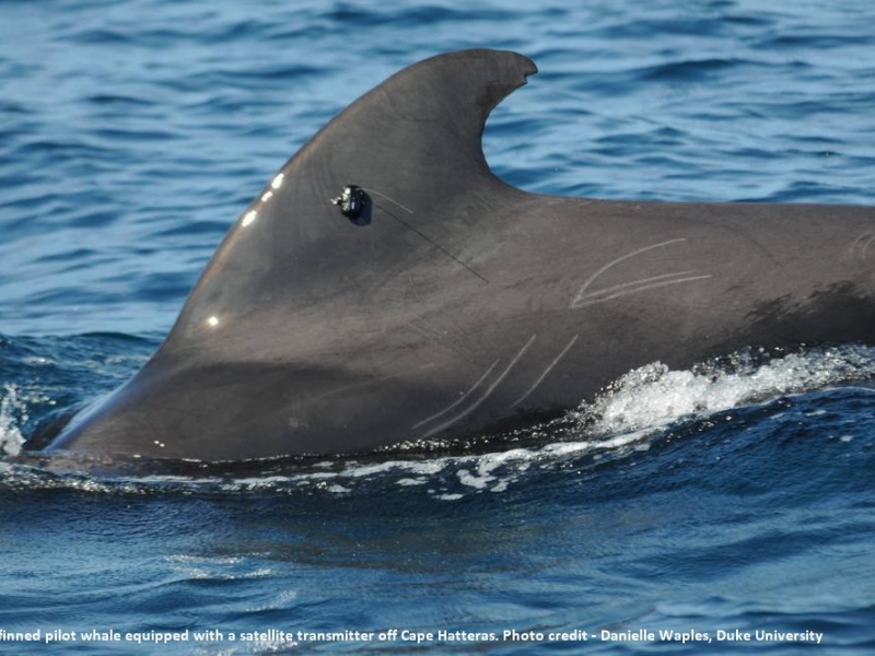
Tagging Deep Diving Odontocetes Off Cape Hatteras - Part 3
September 26, 2014
Details on the 3rd field session for the year.
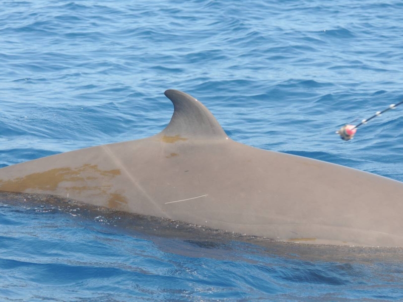
Tagging Whales Off Cape Hatteras
May 21, 2014
Learning about the movements of odontocetes.
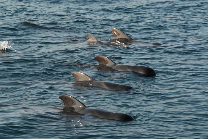
Cape Hatteras Field Work Update
October 28, 2013
Calm days at sea off NC.
Current
Pilot Project to Assess Feasibility of Multi-Sensor Tagging of Rough-Toothed Dolphins at the Pacific Missile Range Facility (PMRF)
Project Objectives
Determine feasibility and efficacy of deploying high resolution multi-sensor tags on rough-toothed dolphins at PMRF and determine how collected data can be used to move toward a better understanding of the effects of Navy activities, ultimately leading to PCoD modelling.
Current
Visual Survey and Tagging of Hawaiian Odontocetes
Project Objectives
(1) define the spatial movement and habitat use patterns of species that are exposed to mid-frequency active (MFA) sonar (2) determine how these patterns influence exposure and potential responses
Complete
Vessel-based Marine Mammal Surveys in Puget Sound, Washington
Project Objectives
Conduct marine mammal in-water vessel-based line transect surveys in the Puget Sound basin to: 1) Record data on all marine mammal species seen with the study area, with a focus on the killer whale (Orcinus orca) and the harbor porpoise (Phocoena phocoena). 2) Identify the seasonal occurrence and abundance/density of cetaceans within the study area. 3) Identify the effects of environmental variables on the distribution and abundance of species in the study area.
Current
Gulf of Alaska Acoustic Moorings and Analysis
Project Objectives
Conduct systematic line transect survey for marine mammals for density estimates; conduct survey to determine ecotype identity of killer whales; analyze existing and newly collected data for seasonal occurrence, abundance, and density of cetacean
Current
Monitoring Cetaceans in Hood Canal
Project Objectives
This 12‑month integrated pilot project combines three complementary components: (A) shore‑based theodolite monitoring of harbor porpoises, (B) high‑bandwidth passive acoustic monitoring and soundscape characterization, and (C) suction‑cup multi‑sensor tag deployments on Bigg’s (transient) killer whales. Together, these data streams will quantify occurrence, movement, diving, and behavioral context for these two key species in relation to the local soundscape—including operational signals near the Dabob Bay Range Complex (DBRC) and the Bangor Trident Base. Results can provide an empirical foundation and inform the study design of future cetacean behavioral response studies (BRS) in Hood Canal.
Complete
Behavioral Response Research Evaluation Workshop II (BRREW II)
Project Objectives
Response
Complete
Mariana Islands Sea Turtle and Cetacean Survey (MISTICS)
Project Objectives
Determine what species of marine mammals and sea turtles are present and estimate abundance.
Complete
Pilot study for shore based humpback surveys in Saipan
Project Objectives
Humpback whale nearshore distribution in nearshore Saipan waters
Complete
Pilot survey for humpback whales at Farallon de Medinilla
Project Objectives
The goal of the visual surveys is to collect individually-identifying information from humpback whales present near and around Farallon de Medinilla (FDM)
Complete
Small vessel visual surveys in the Mariana Islands Range Complex
Project Objectives
Identify species of beaked whales, odontocetes, and baleen whales that occur in the Mariana Islands; Monitor marine mammal and sea turtle presence, distribution, and diversity in nearshore waters during key seasons (summer and winter); Develop a better understanding of marine mammal distribution, movement patterns, habitat use, population structure, and abundance; Develop reference library of visually-validated acoustic recordings of marine mammals.
Current
Estimation of Received Levels of MFAS and Behavioral Response of Marine Mammals at PMRF
Project Objectives
Further our understanding of the Monitoring Questions: 1) What is the occurrence and estimated received levels of MFAS on 'blackfish', humpback, minke, sperm and Blainville's beaked whales within the PMRF instrumented range? and 2) What, if any, are the short term behavioral responses of 'blackfish,' humpback, minke, sperm and Blainville's beaked whales when exposed to MFAS/explosions at different levels/conditions at PMRF?
Current
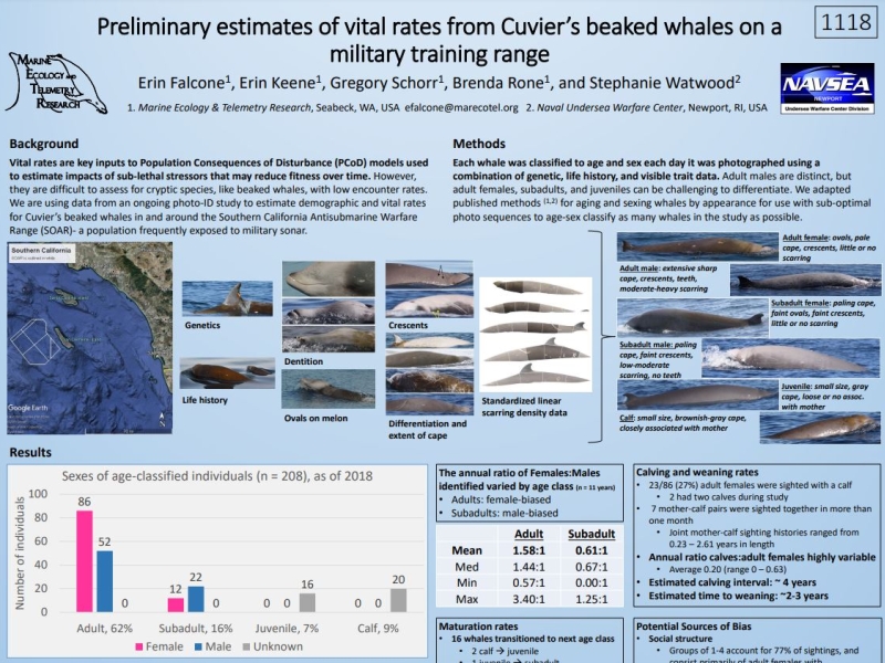
Goose-Beaked Whale and Fin Whale Population Dynamics and Impact Assessment at the Southern California Offshore Antisubmarine Warfare Range (SOAR)
Project Objectives
Improve knowledge of baseline population demographics, vital rates, and movement patterns of Cuvier’s beaked whales and fin whales. Examine what, if any, short term behavioral and/or vocal responses occur when exposed to sonar or explosions at different levels and conditions. Determine if exposure to sonar or explosives impact the long term fitness and survival of individuals or the population, species, or stock
Current
Southern California Beaked Whale Occurrence (formerly "Passive Acoustic Monitoring of Marine Mammals in Southern California Range Complex (SOCAL)")
Project Objectives
Determine the distribution and temporal patterns of beaked whale occurrence in the waters within and outside the Southern California Range Complex (SOCAL). Use passive acoustic monitoring to determine what species are present in SOCAL and examine spatial and temporal patterns.
Complete
NAS Patuxent River Marine Species Surveys
Project Objectives
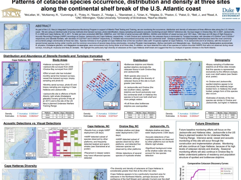
Assess occurrence, seasonality, and abundance of Tursiops in the waters near NAS PAX River
Complete
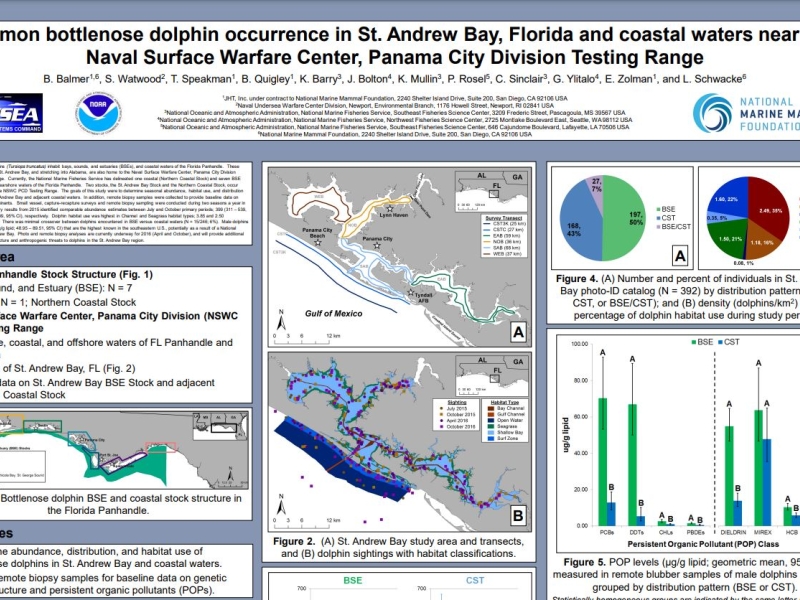
Bottlenose Dolphin Occurrence in Estuarine and Coastal Waters near Panama City, Florida
Project Objectives
Determine species occurrence, and distribution, habitat use, and abundance of Tursiops in St. Andrew Bay and coastal waters adjacent to the Naval Surface Warfare Center, Panama City Division.
Complete
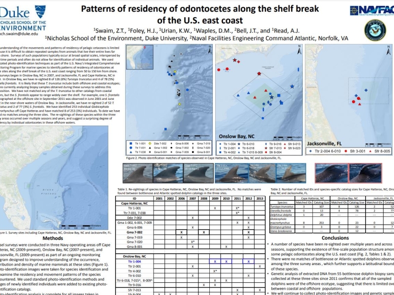
Baseline Monitoring for Marine Mammals in the East Coast Range Complexes (vessel surveys)
Project Objectives
Assess occurrence, habitat associations, and stock structure of marine mammals and sea turtles in key areas of Navy range complexes
Complete
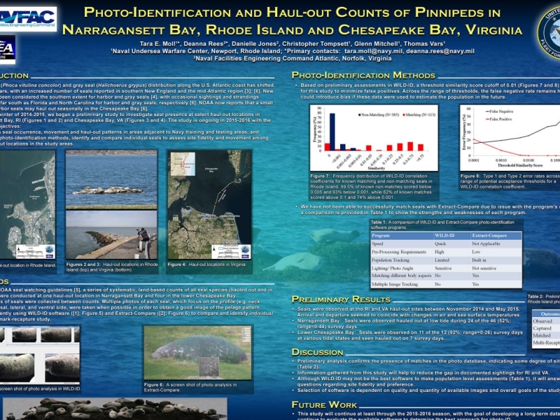
Haul-Out Counts and Photo-Identification of Pinnipeds in Narragansett Bay, RI
Project Objectives
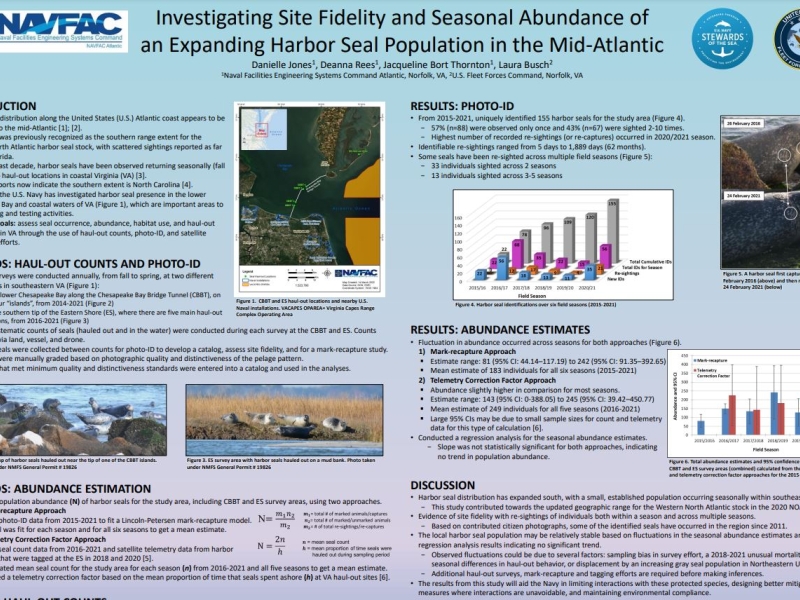
Document seasonal occurrence, habitat use, and haul-out patterns of seals
Complete
North Atlantic Right Whale Monitoring in the Southeast Calving Area
Project Objectives
Assess behavior of right whales in coastal waters of the Southeast calving grounds, including rates of travel of individuals, dive behavior, and rates of sound production
Complete
Occurrence, Distribution, and Density of Marine Mammals Near Naval Station Norfolk and Virginia Beach
Project Objectives
Assess occurrence, seasonality, and abundance of Tursiops in the coastal waters of Hampton Roads military installations
Complete
Mid-Atlantic Humpback Whale Catalog
Project Objectives
Establish a centralized collaborative humpback whale photo-id catalog for the mid-Atlantic and southeast regions to support management and environmental planning
Complete
Mid-Atlantic Humpback Whale Monitoring
Project Objectives
Assess occurrence, habitat use, and baseline behavior of humpback whales in the mid-Atlantic region
Complete
Occurrence, Ecology, and Behavior of Deep-diving Odontocetes
Project Objectives
Establish behavioral baseline and foraging ecology. Assess behavioral response to acoustic stimuli and Navy training activities
Complete
Pinniped Monitoring in the Northeast
Project Objectives
Document habitat use, haul-out patterns, and baseline behavior of seals
Complete
North Pacific Humpback Whale Tagging
Project Objectives
Determine the occurrence, movement patterns, and residency patterns of multiple humpback whale Distinct Population Segments within Pacific Ocean Navy Range Complexes
Current
Pacific Islands Comprehensive Stranding Investigations
Project Objectives
Conduct comprehensive investigations of stranded marine mammals throughout the Pacific Islands with emphasis on the Hawaiian and Mariana Island chains. This includes conducting necropsies of stranded animals, collecting and archiving samples, conducting disease screening, genetic testing, and analysis of historical data. The objective is to examine stranding patterns and causes of death for marine mammals in the Pacific Islands.
Complete
Blue and Fin Whale Satellite Tagging
Project Objectives
Determine the movement patterns, occurrence, and residence times of blue whales and fin whales within U.S. Navy training and testing areas as well as Biologically Important Areas along the U.S. West Coast
Complete
Offshore Distribution of Southern Resident Killer Whales in the Pacific Northwest
Project Objectives
1) Identify and classify Southern Resident killer whale (SRKW) detections from acoustic recorders and satellite tag tracking; 2) Develop a model to estimate the seasonal and annual occurrence patterns of southern resident killer whales relative to offshore Navy training ranges. 3) Characterize occurrence of anthropogenic sounds in potential SRKW habitat. 4) Develop state space habitat model for SRKW prey, based on fall Chinook salmon tagged released from California to British Columbia between 1977 and 1990 to estimate seasonal distribution along the west coast.
Complete
Acoustic and Visual Survey for Cetaceans in Behm Canal and Southern Clarence Strait, Alaska
Project Objectives
Conduct visual line-transect surveys and passive acoustic monitoring for cetaceans, and other marine mammals, to determine species occurrence, and to estimate density within Navy’s testing range. Acoustic monitoring devices will be deployed during the vessel based survey, and long-term passive acoustic hydrophones will be monitored for year-round detection of rare and/or cryptic cetacean species.
Current
Pacific Marine Assessment Program for Protected Species (PACMAPPS) survey
Project Objectives
Identify species of beaked whales, odontocetes, and baleen whales that occur in the surveyed areas; Monitor marine mammal and sea turtle presence, distribution, and diversity in offshore waters; Develop a better understanding of marine mammal distribution, movement patterns, habitat use, population structure, and abundance; Develop reference library of visually-validated acoustic recordings of marine mammals.
Current
Jacksonville Shallow Water Training Range Vessel Surveys and M3R Species Verifications
Project Objectives
Monitor species composition and distribution on JSWTR, support M3R species verifications
Current
Distribution of Gulf Sturgeon in the Panama City Testing Range
Project Objectives
Assess Gulf Sturgeon distribution and habitat use through a multi-phase biotelemetry approach
Current
Mid-Atlantic Offshore Cetacean Study
Project Objectives
Assess occurrence, habitat use, and baseline behavior of cetaceans in the offshore and continental shelf break region of the VACAPES OPAREA
Complete
Atlantic Marine Assessment Program for Protected Species (AMAPPS)
Project Objectives
Assess the abundance, distribution, ecology, and behavior of marine mammals, sea turtles, and seabirds in U.S. Atlantic EEZ
Current
Mid-Atlantic Nearshore & Mid-shelf Baleen Whale Monitoring
Project Objectives
Assess occurrence, habitat use, and baseline behavior of baleen whales in the mid-Atlantic region
Current
Atlantic Behavioral Response Study
Project Objectives
Assess behavioral response of beaked and pilot whales to mid-frequency tactical sonar
Current
Haul-Out Counts and Photo-Identification of Pinnipeds in Virginia
Project Objectives
Document seasonal occurrence, habitat use, and haul-out patterns of seals
Complete
Pinniped Tagging and Tracking in Southeast Virginia
Project Objectives
Document habitat use, movement and haul-out patterns of seals in the Hampton Roads region of Chesapeake Bay and coastal Atlantic Ocean
More details
Collapse details
Date Published:
Filesize:
- July 11, 2011
Ecological acoustic recorders (EARs) have been deployed around the islands of Oahu and Kauai in a project sponsored by the Office of Naval Research. Detailed information on the EAR was published by Lammers et al. (2008). EARs have been deployed from February, 2009 to the present time around Oahu and from February, 2009 until April, 2011 around Kauai. From April, 2011 four EARs in the waters of Kauai have been deployed along the southern coast.
- 1,372.43 KB
More details
Collapse details
Date Published:
Filesize:
- November 1, 2018
In August 2017, a marine mammal monitoring project was carried out combining boat-based field efforts and passive acoustic monitoring on and around the Pacific Missile Range Facility (PMRF). Commander, Pacific Fleet (PACFLT) funded five days of small-boat effort and the National Marine Fisheries Service funded an additional six days of effort. Information obtained was compared to previous sightings during small-boat effort by Cascadia Research Collective (CRC) off Kauai and Niihau, during 1,119 hr of effort (19,194 km) over nine different years from 2003 through 2016 (see Baird 2016)
- 2,093.16 KB
More details
Collapse details
Date Published:
Filesize:
- November 30, 2023
As part of the long-term United States (U.S.) Navy-funded Marine Species Monitoring Program, from 5-13 August 2023, Cascadia Research Collective (CRC) carried out a vessel-based field effort in conjunction with passive acoustic monitoring undertaken by U.S. Navy (Navy) scientists on and around the underwater hydrophone ranges of the Pacific Missile Range Facility (PMRF).
- 2,846.35 KB
More details
Collapse details
Date Published:
Filesize:
- June 7, 2019
As part of a long-term U.S. Navy-funded marine mammal monitoring program, in August 2018 a combination of vessel-based field effort and passive acoustic monitoring was carried out on and around the Pacific Missile Range Facility (PMRF) Kaua‘i prior to a Submarine Commander Course scheduled for mid-August 2018. The purpose of the monitoring effort was to assess the spatial movement patterns and habitat use of cetaceans that are exposed to mid-frequency active sonar and how those patterns influence exposure and potentially responses.
- 10,036.77 KB
More details
Collapse details
Date Published:
Filesize:
- June 1, 2017
As part of a long-term U.S. Navy-funded marine mammal monitoring program, in February 2016 a combining boat-based field effort and passive acoustic monitoring was carried out on and around the Pacific Missile Range Facility (PMRF). The U.S. Navy funded five days of small-boat effort and the National Marine Fisheries Service funded an additional two days of effort. There were 859 kilometers (49 hours) of small-vessel survey effort over the course of the seven day project.
- 2,847.59 KB
More details
Collapse details
Date Published:
Filesize:
- November 8, 2013
Here we combine results of field efforts funded through the U.S. Navy’s Living Marine Resources Program (through a three-year grant from the Naval Postgraduate School) as well as additional field time in the study area in 2011 and 2012 funded through the Pacific Islands Fisheries Science Center and Commander, Pacific Fleet. We also utilize results from research efforts in the eastern main Hawaiian Islands, off Lāna‘i, Maui, and Hawai‘i Island, to help interpret results from photo-identification and satellite tagging.
- 2,159.00 KB
More details
Collapse details
Date Published:
Filesize:
- June 7, 2012
Although considerable information is available on residency patterns and spatial use of odontocetes in the eastern half of the Hawai‘i Range Complex (HRC), much less is known about odontocetes in the western half of the HRC. In the second year of a three-year effort in the western main Hawaiian Islands we undertook surveys off Kaua‘i and Ni‘ihau in July/August 2011, to examine spatial use and residency patterns using satellite tags, to provide visual verification of acoustically-detected odontocetes on the Pacific Missile Range Facility (PMRF), and to obtain individual identification photographs and biopsy samples for assessment of population identity and structure.
- 3,048.07 KB
More details
Collapse details
Date Published:
Filesize:
- February 1, 2011
Movements and Spatial Use of Satellite‐tagged Odontocetes in the Western Main Hawaiian Islands: Results of Fieldwork Undertaken off O‘ahu in October 2010 and Kaua‘i in February 2011
- 1,236.87 KB
Using dolphins to catch tuna: Assessment of associations between pantropical spotted dolphins and yellowfin tuna hook and line fisheries in Hawai‘i.
Fisheries Research. 2020.
230:105652
More details
Collapse details
Date Published:
Publication:Ocean:Region:Species:Methods:
- October 1, 2020
In Hawaiian waters fishermen use the association between pantropical spotted dolphins (Stenella attenuata) and yellowfin tuna (Thunnus albacares) to catch tuna. Targeting fishing effort around or in spotted dolphin groups has the potential to lead to bycatch, and anecdotal reports of hooking dolphins exist. We recorded information on fishing vessels associated with spotted dolphin groups from 2008 through 2018 to inform discussions about potential bycatch. Associations occurred from Oʻahu to Hawaiʻi Island, but were most prevalent off Hawaiʻi Island, where 29.7 % of spotted dolphin groups had fishing vessels present
Aerial Surveys for Protected Marine Species in the Jacksonville OPAREA: 2017 Annual Progress Report.
More details
Collapse details
Date Published:
Filesize:
- April 1, 2018
This report represents one facet of a collaborative multi-institutional monitoring project intended to provide information on the species composition, population identity, density and baseline behavior of marine mammals and sea turtles present in United States (U.S.) Navy range complexes along the U.S. Atlantic Coast.
- 16,812.91 KB
More details
Collapse details
Date Published:
Filesize:
- August 1, 2017
This report describes results of vessel surveys from a multi-institutional monitoring project intended to provide information on the species composition, population identity, density, and baseline behavior of marine mammals and sea turtles present in United States (U.S.) Navy range complexes along the U.S. Atlantic Coast.
- 9,204.20 KB
More details
Collapse details
Date Published:
Filesize:
- May 1, 2019
This report summarizes the aerial survey effort conducted at the JAX site from 2009 through 2017. The monitoring project was intended to provide information on the species composition, density, and spatial distribution of marine mammals and sea turtles present in Navy’s JAX operating area (OPAREA), with particular focus on the intended site of the USWTR. These aerial surveys extended over nine years and yielded a very detailed seasonal picture of the occurrence, distribution and abundance of marine mammals and sea turtles in the region. This work also provides an important baseline against which future changes in the marine mammal and sea turtle fauna can be assessed.
- 2,580.34 KB
Protected Species Monitoring in the Proposed Undersea Warfare Training Range Offshore of Jacksonville, FL .
SEAMAMMS (Southeast and Mid-Atlantic Marine Mammal Symposium). .
More details
Collapse details
Date Published:
Filesize:
- March 22, 2013
A multi-institutional marine protected species monitoring program involving aerial, vessel and acoustic surveillance techniques was implemented at the proposed Undersea Warfare Training Range (USWTR) offshore of Jacksonville, Florida in January 2009. Visual surveys, in conjunction with acoustic sampling methods, have been conducted to investigate cetacean and sea turtle occurrence, distribution and abundance. Through December 2012 a total of 722 aerial tracklines (60687 km) were flown, resulting in 641 cetacean sightings, encompassing 8079 individuals. Tursiops truncatus and Stenella frontalis were the most frequently encountered, followed by Grampus griseus, Globicephala macrorhynchus, Balaenoptera acutorostrata, Steno bredanensis, Eubalaena glacialis, Megaptera novaeangliae, Physeter macrocephalus, and Kogia spp. Cetaceans were encountered 126 times during the 3403 km of vessel surveys, totaling 950 individuals. Sightings consisted of S. frontalis, T. truncatus, G. macrorhynchus, and G. griseus. Across all visual platforms, T. truncatus were encountered throughout the range, whereas S. frontalis, S. bredanensis, and E. glacialis were recorded exclusively in shelf waters. All other species were detected only in pelagic waters. The towed passive acoustic array was deployed during 21 vessel surveys, generating 24.2 hours of recordings, detecting all four sighted species. High frequency acoustic recording packages (HARPs) were deployed at two sites in the study area for long‐term passive acoustic monitoring. The HARP data have been analyzed for diel, seasonal, and interannual trends in cetacean occurrence. Surveys are scheduled to continue in order to asses long‐term habitat usage patterns in the USWTR.
- 399.45 KB
More details
Collapse details
Date Published:
Filesize:
- January 1, 2011
Cetacean distribution and abundance are reported from the first systematic line-transect visual survey in the waters of Guam and the Commonwealth of the Northern Mariana Islands (CNMI). The survey was conducted during January–April 2007 following standard line-transect protocols. Trackline coverage (11,033 km) was dominated by high sea states (88.2%); however, 13 cetacean species were recorded.
- 3,581.88 KB
Distribution and Abundance Estimates for Cetaceans in the Waters of Guam and the Commonwealth of the Northern Mariana Islands.
Pacific Science. 2011.
Vol. 65, no. 3:321 – 343
More details
Collapse details
Date Published:
Publication:Ocean:Region:Species:Methods:
- January 1, 2011
Cetacean distribution and abundance are reported from the first systematic line-transect visual survey in the waters of Guam and the Commonwealth of the Northern Mariana Islands (CNMI). The survey was conducted during January–April 2007 following standard line-transect protocols.
More details
Collapse details
Date Published:
Filesize:
- November 1, 2012
The first phase to integrate the historical sum of these U.S. Navy-sponsored visual survey efforts for marine species monitoring in the HRC was prepared by Uyeyama (2011). This report represents the second phase of that effort and presents an overview of monitoring survey effort to date in the HRC. Available data from visual surveys performed by both contractor-led efforts and U.S. Navy in-house surveys was compiled and processed in order to: 1. Create a geographic information system (GIS)-based summation of all survey tracks that can be easily visualized. 2. Construct a geo-referenced database of sightings that can be queried by species, observer platform, Beaufort Sea State (BSS), season, or other sighting/survey variables. 3. Conduct an enhanced analysis of sighting success with respect to survey platform, field protocol, and environmental conditions. 4. Inform and adjust data collection procedures on future surveys as needed to reflect lessons learned from sighting data compilation efforts presented here. 5. Provide information to enhance informed management of marine protected species in the HRC and support the adaptive management process that is part of the ICM
- 19,704.58 KB
- Hawaiian Monk Seal
- Green turtle
- Bryde's whale
- Humpback whale
- Minke whale
- Sei whale
- Blainville's beaked whale
- Bottlenose dolphin
- Goose-beaked whale
- Fraser's dolphin
- Killer whale
- Longman’s beaked whale
- Melon-headed whale
- Pantropical spotted dolphin
- Pygmy killer whale
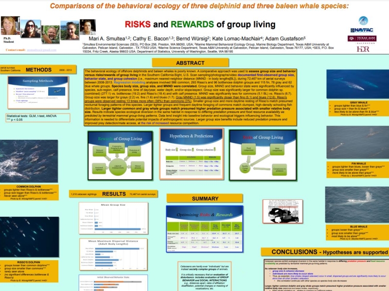
- Risso's dolphin
- Rough-toothed dolphin
- Short-finned pilot whale
- Spinner dolphin
- Striped dolphin
More details
Collapse details
Date Published:
Filesize:
- September 19, 2024
This report presents a geographic information system (GIS)-based overview of the sighting records obtained during marine species monitoring effort (a total of 12 U.S. Pacific Fleet-funded surveys) to date in the MIRC. Also included are incidental marine mammal and sea turtle sightings made since 1965 on non-dedicated surveys in the region.
- 14,571.64 KB
More details
Collapse details
Date Published:
Filesize:
- March 1, 2012
This report presents the results of the Guam and Saipan Marine Species Monitoring: Winter-Spring Survey conducted on the motor vessel (M/V) Sea Fantasy (Guam survey) and the M/V Super Emerald (Saipan survey) from 15 to 29 March 2012. The objective of the 2012 survey effort was to conduct baseline surveys to further document marine mammal and sea turtle occurrence in nearshore waters around the island of Guam and Saipan. The approach primarily followed opportunistic survey protocols used in recent surveys around Guam (Ligon et al. 2011; HDR 2011), which remained within 10 kilometers (km) or 5.4 nautical miles (NM) of the coastline.
- 998.39 KB
More details
Collapse details
Date Published:
Filesize:
- August 31, 2012
The overall objective of the ICMP is to assimilate relevant data collected across U.S. Navy range complexes in order to answer questions pertaining to the impact of MFAS and explosives on marine mammals and sea turtles.
- 11,672.29 KB
More details
Collapse details
Date Published:
Filesize:
- June 1, 2011
This report presents the results of marine mammal monitoring for the Koa Kai 11‐1 training event, and represents the continued monitoring efforts under the U.S. Navy’s Marine Species Monitoring Program. The objectives of the vessel‐based monitoring effort for Koa Kai 11‐1 consisted of the following: Perform focal behavioral follows of marine mammals during the course of a training event involving ASW. Assess the occurrence, distribution, and behavior of target species (marine mammals and sea turtles) using a vessel‐based line transect survey within the HRC in waters within or adjacent to the area where ships were training. Locate individual false killer whales (Pseudorca crassidens), pygmy killer whales (Feresa attenuata), and short‐finned pilot whales (Globicephala macrorhynchus) tagged by Dr. Robin Baird with Cascadia Research. Investigate the occurrence, distribution, and behavior of target species (marine mammals and sea turtles) using vessel‐based line transect survey in waters within or adjacent to the area where Navy ships were training
- 2,377.86 KB
More details
Collapse details
Date Published:
Filesize:
- July 1, 2025
In August 2023 and February 2024, Cascadia Research Collective (CRC) conducted small boat-based satellite tagging of odontocetes at the Pacific Missile Range Facility (PMRF), with acoustic support from Naval Information Warfare Center (NIWC) Pacific and Naval Undersea Warfare Center (NUWC) Newport, directing the tagging boat towards locations of acoustic detections on the range. Seventeen days of tagging effort were conducted over the two years during the biannual Submarine Command Course (SCC) training events. In total 19 odontocetes were tagged: 14 short-finned pilot whales (Globicephala macrorhynchus), 3 common bottlenose dolphins (Tursiops truncatus), 1 pantropical spotted dolphin (Stenella attenuata), and 1 melon-headed whale (Peponocephala electra). Additionally, 3 humpback whales (Megaptera noveangliae) were tagged in concert with this effort to test new tags, and that data was also analyzed herein
- 8,338.72 KB
More details
Collapse details
Date Published:
Filesize:
- March 2, 2017
The Pacific Islands Fisheries Science Center’s (PIFSC) Cetacean Research Program (CRP) has been conducting visual surveys and long-term acoustic monitoring for cetaceans in the waters surrounding Guam and the Commonwealth of the Northern Mariana Islands (CNMI) as part of an ongoing effort to develop a record of cetacean occurrence in the region. Visual surveys have been conducted aboard small boats (7.6-12.2 m) since 2010 off the southernmost islands of the Mariana Archipelago (Guam, Rota, Saipan, Tinian, and Aguijan). These surveys include the collection of photographs for individual identification, tissue samples for genetic analysis of population structure, and the deployment of satellite tags for assessment of individual movements throughout the broader region
- 2,999.73 KB
More details
Collapse details
Date Published:
Filesize:
- January 1, 2012
The Pacific Islands Fisheries Science Center’s (PIFSC) Cetacean Research Program (CRP) conducted surveys for cetaceans in the waters surrounding Guam and the Commonwealth of the Northern Mariana Islands (CNMI) (Figure 1) in an effort to further develop a record of cetacean occurrence in the region and to gather photos and biopsy samples for population studies. This project was carried out in partnership with the U.S. Navy Commander, Pacific Fleet by a team of six primary personnel (Table 1).
- 1,134.77 KB
More details
Collapse details
Date Published:
Filesize:
- May 3, 2019
The Pacific Islands Fisheries Science Center’s (PIFSC) Cetacean Research Program (CRP) has conducted visual surveys for cetaceans in the waters surrounding Guam and the Commonwealth of the Northern Mariana Islands (CNMI) since 2010 as part of an ongoing effort to develop a record of cetacean occurrence in the region. During 24 August–9 September 2018, non-systematic visual surveys were conducted from small vessels off Saipan, Tinian, Aguijan, and Guam. A total of 1,168 km of trackline was surveyed and most was in Beaufort sea states of 2–4 (73%) and swell heights of 0–4 ft (71%). Twenty cetacean groups were encountered, resulting in the collection of 6,437 photos, 33 biopsy samples, and the deployment of 5 satellite tags.
- 3,454.46 KB
More details
Collapse details
Date Published:
Filesize:
- March 1, 2019
The PIFSC CRP has conducted research on cetaceans in the Mariana Archipelago since 2010. A cooperative effort with funding from U.S. Navy Pacific Fleet and PIFSC has included summer and winter small-boat surveys off the southernmost islands (Saipan, Tinian, Aguijan, Rota, and Guam), development of photo-ID catalogs, analysis of collected tissue samples and satellite telemetry tag data, and shipboard visual and PAM surveys in portions of the EEZ in 2010 and 2015. PIFSC has maintained long-term PAM on moored recorders off Saipan and Tinian (since 2010) and off Pagan (since 2015) as part of the Pacific Islands Passive Acoustic Network (PIPAN). The goal of these efforts is to collect the data necessary to conduct population assessments for cetaceans within the Mariana Archipelago, including the determination of their occurrence, population structure and abundance, movements, distribution, and habitat use.
- 6,884.39 KB
More details
Collapse details
Date Published:
Filesize:
- February 1, 2013
A long-term goal of this research is the evaluation of the population status of each cetacean stock. This includes producing population abundance estimates using mark-recapture techniques. The first step in the process is the creation of species photo-identification catalogs, which began during the summer of 2012
- 2,353.37 KB
More details
Collapse details
Date Published:
Filesize:
- January 1, 2016
The Pacific Islands Fisheries Science Center’s (PIFSC) Cetacean Research Program (CRP) has been conducting visual surveys and long-term acoustic monitoring for cetaceans in the waters surrounding Guam and the Commonwealth of the Northern Mariana Islands (CNMI) as part of an ongoing effort to develop a record of cetacean occurrence in the region. Visual surveys have been conducted aboard small boats (7.6-12.2 m) since 2010 off the southernmost islands of the Mariana Archipelago (Guam, Rota, Saipan, Tinian, and Aguijan). These surveys include the collection of photographs for individual identification, tissue samples for genetic analysis of population structure, and the deployment of satellite tags for assessment of individual movements throughout the broader region.
- 3,259.39 KB
More details
Collapse details
Date Published:
Filesize:
- January 1, 2013
e Pacific Islands Fisheries Science Center’s (PIFSC) Cetacean Research Program (CRP) conducted surveys for cetaceans in the waters surrounding Guam and the Commonwealth of the Northern Mariana Islands (CNMI) in an effort to further develop a record of cetacean occurrence in the region.1 This was the fourth year conducting cetacean surveys aboard small boats (7.6 – 12.2 m) around the southern Mariana Islands of Guam, Rota, Saipan, Tinian, and Aguijan (Fig. 1). This project was carried out in partnership with the Commander, U.S. Pacific Fleet by a team of four primary personnel (Table 1). The collected data are being used to reveal the occurrence and distribution, stock structure, and movements of cetaceans within the study area.
- 1,488.70 KB
More details
Collapse details
Date Published:
Filesize:
- March 27, 2015
The Pacific Islands Fisheries Science Center’s (PIFSC) Cetacean Research Program (CRP) has been conducting visual surveys for cetaceans in the waters surrounding Guam and the Commonwealth of the Northern Mariana Islands (CNMI) and collecting long-term passive acoustic monitoring data at two sites in CNMI as part of an ongoing effort to develop a record of cetacean occurrence in the region. Visual surveys, conducted aboard small boats (7.6 – 12.2 m), have been ongoing since 2010 off the southern Mariana Islands of Guam, Rota, Saipan, Tinian, and Aguijan. T
- 3,614.97 KB
More details
Collapse details
Date Published:
Filesize:
- September 2, 2014
an effort to further develop a record of cetacean occurrence in the region, as well as to gather photos and biopsy samples and deploy satellite tags for population studies, the Pacific Islands Fisheries Science Center's (PIFSC) Cetacean Research Program (CRP) conducted surveys for cetaceans in the waters surrounding Guam and the CNМІ (Figure 1) during 2010-2014. This research was carried out in partnership with the U.S. Navy and is expected to continue through 2015. Detailed reports for each survey year were submitted to the Navy (Oleson and Hill 2010, Ligon et al. 2011, Hill et al. 2012, Hill et al. 2013).
- 4,374.27 KB
Cetacean Research in the Marianas.
NMFS-PIFSC External Program Review of Protected Species Science .
More details
Collapse details
Date Published:
Filesize:
- April 16, 2026
Goals: Understand species occurrence and distribution. Determine the population structure and abundance of the those species. Study the movements and habitat use of individuals and populations. Methods: Small boat-based and ship-based surveys. Passive acoustic recordings (HARPs & towed array). Photo-ID, biopsy sampling, and satellite tagging.
- 5,971.92 KB
Biologically Important Areas II for cetaceans within U.S. and adjacent waters – Hawaiʻi Region.
Frontiers in Marine Science. 2023.
10:21
More details
Collapse details
Date Published:
Publication:Ocean:Region:Species:Methods:
- January 25, 2023
In this assessment we incorporated published and unpublished information to delineate and score Biologically Important Areas (BIAs) for cetaceans in the Hawaiʻi region following standardized criteria. Twenty-six cetacean species have been documented in Hawaiʻi. Eleven odontocete species have distinct small populations resident to one or more island areas: rough-toothed dolphins, pantropical spotted dolphins, common bottlenose dolphins, spinner dolphins, short-finned pilot whales, false killer whales, pygmy killer whales, melon-headed whales, Blainville’s beaked whales, Cuvier’s beaked whales, and dwarf sperm whales.
More details
Collapse details
Date Published:
- January 10, 2016
Species diversity and abundance at a cetacean "hot spot" off Cape Hatteras, North Carolina, USA.
21st Biennial Conference on the Biology of Marine Mammals .
More details
Collapse details
Date Published:
Filesize:
- December 13, 2015
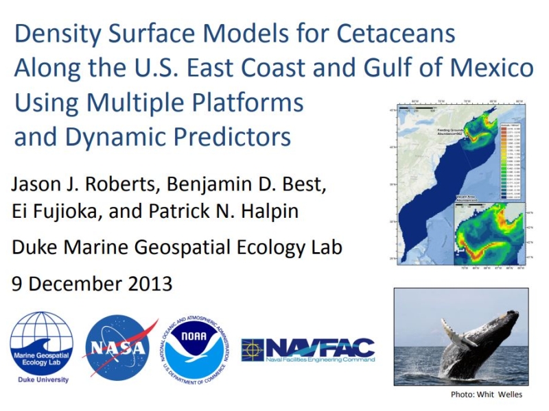
We have been conducting ongoing monthly aerial surveys off Cape Hatteras, NC, USA as part of the US Navy's marine species monitoring program in the Atlantic since 2011. We utilize line transect survey methods and extensively photograph all sightings to confirm species identification. Survey tracklines extend from shallow continental shelf waters, across the shelf break, to deep pelagic waters. From May 2011 through December 2014, 26,131km of trackline were flown, and 9,941 individual cetaceans were documented during 437 encounters. Nineteen species of cetaceans, including three mysticetes (Balaenoptera physalus, B. acutorostrata, Megaptera novaeangliae), five deep-divers (Physeter microcephalus, Kogia spp., Ziphius cavirostris, Mesoplodon europaeus, M. mirus), and eleven delphinids (Tursiops truncatus, Stenella frontalis, S. attenuate, S. coeruleoalba, S. clymene, S. longirostris, Steno bredanensis, Peponocephala electra, Lagenodelphis hosei, Grampus griseus and Globicephala macrorhynchus) were encountered. Similar surveys at the adjacent Onslow Bay, NC site yielded only 257 sightings (4,773 individuals representing nine species) despite nearly two times the survey effort flown (48,698km). At Cape Hatteras, minimum abundance estimates (i.e. uncorrected for availability or perception bias) were generated using spatio-temporal density surface modelling for species with sufficient detections. Predicted monthly abundance of T. truncatus varied between 170 (95% confidence interval; 0 - 17,100) and 3,450 (300 - 8,510). Monthly Stenella spp. abundance varied between 110 (0 - 360) and 1,720 (400 - 5,390). Monthly abundance of G. macrorhynchus varied between 10 (0 - 960) and 1,230 (220 - 4,300). These results demonstrate that the waters off Cape Hatteras support both higher diversity and density of cetaceans than adjacent waters along the US Atlantic coast. This site is included in the area of interest identified in six pending permits for large-scale, commercial seismic surveys. We suggest that the high density and diversity of cetaceans at this site warrants a special degree of concern by the US Bureau of Ocean Energy Management.
- 92.54 KB
More details
Collapse details
Date Published:
Filesize:
- April 1, 2016
In 2015 field efforts were carried out at the U.S. Navy’s Atlantic Undersea Test and Evaluation Center (AUTEC) during two time periods prior to the spring and fall Submarine Commander Courses (SCC). The tests were conducted under the auspice of the Living Marine Resources Program (LMR) and the Office of Naval Research (ONR). The first took place April 23rd – May 11th, and the second October 24th – November 6th. There was an additional test conducted from August 10th – 23rd when range activity was low and weather conditions are generally better, thus maximizing the opportunities for locating and tagging beaked whales to gather baseline data.
- 267.04 KB
More details
Collapse details
Date Published:
Filesize:
- November 1, 2013
During 2007, the first large-scale survey for marine mammals and sea turtles -- the Mariana Islands Sea Turtle and Cetacean Survey (MISTCS) -- was conducted in the Navy’s Mariana Islands Range Complex (MIRC; DoN 2007, Fulling et al. 2011). The survey region encompassed approximately 584,800 square kilometers (km2) and was a rectangle bounded by 18° – 10° N and 142° –148° E. The survey used standard line-transect methodology and also included passive acoustic monitoring (PAM) using a towed hydrophone array system.
- 12,713.19 KB
More details
Collapse details
Date Published:
Filesize:
- March 22, 2022
The United States (US) Navy uses lookouts (LOs) to detect objects in the water in the vicinity of ships. One class of object that LOs are trained to detect is marine mammals ; this forms an important component of the Navy’s procedures for marine mammal mitigation during training activities . As well as dedications of marine mammals by these LOs, detections of marine mammals may also be made by other members of the ship’s crew such as officers on the bridge (“watchstanders”) or sonar technicians, although acoustic detections require visual confirmation. We refer to these personnel together as the “lookout team” (LT). The primary goal of this project was to determine how effective LTs are at detecting marin
- 4,078.84 KB
- California sea lion
- Green turtle
- Leatherback turtle
- Loggerhead turtle
- Kemp's Ridley turtle
- Blue whale
- Fin whale
- Humpback whale
- Minke whale
- Atlantic white-sided dolphin
- Common dolphin
- Harbor porpoise
- Killer whale
- Pantropical spotted dolphin
- Pilot whale
- Risso's dolphin
- Rough-toothed dolphin
- Short-finned pilot whale
- Sperm whale
- Spotted dolphin
- Striped dolphin
The call of the wily: Using acoustics to identify delphinid species not visually confirmed in the waters around Guam and the Northern Mariana Islands.
Southern California Marine Mammal Workshop 2014 .
More details
Collapse details
Date Published:
Filesize:
- January 31, 2014
During a combined visual and acoustic cetacean abundance survey that took place in the waters around Guam and the Northern Mariana Islands, delphinid whistles were frequently detected, but were not always coupled with visual observations. As a resu lt, many acoustic detections were not identified to spec ies. Very little data exist on the occurrence and distribution of delphinids in this study area, so the ability to acoustically identify species that were not sighted can provide important information regard ing the occurrence and distribution of delphinid species in these waters.
- 1,513.42 KB
More details
Collapse details
Date Published:
Filesize:
- August 1, 2007
The objective of Mariana Islands Sea Turtle and Cetacean Survey (MISTCS) was to conduct the first systematic line-transect visual survey of the waters around Guam and the Northern Mariana Islands and generate density estimates for those species which had adequate data.
- 6,725.14 KB
More details
Collapse details
Date Published:
Filesize:
- September 26, 2014
The purpose of this report is to compile previously unpublished sightings of marine mammals and sea turtles made in the Mariana Islands Range Complex. The original primary goal of this report was to compile such sightings incidentally made during Navy-funded field efforts or other Navy training. However during the course of compiling these data, additional incidental sightings made by other sources were encountered.
- 1,354.66 KB